Places and People Forest of Dean
- About the Forest of Dean
- Abenhall, Gloucestershire
- Anchor Inn, Lydbrook
- Ariconium, Herefordshire
- Arthur and Edward Colliery
- Bigsweir, Gloucestershire
- Bishopswood, Herefordshireshire
- Bixslade (Bicslade)
- Blakeney, Gloucestershire
- Bloomery (definition)
- Bradley House
- Bream, Gloucestershire
- Bullo Pill, Gloucestershire
- Cannop Colliery
- Cinderford, Gloucestershire
- Clearwell, Gloucestershire
- Coleford, Gloucestershire
- Collieries
- Crawshay, Henry
- Danby Lodge
- Darkhill Brick, Colliery + Ironworks
- Dates in the Forest of Dean
- Dean Forest (Mines) Act 1838
- Dean Forest Railway
- Dean Forest (Reafforestation)
Act 1668 - The Dean Forest Riots
- Dean Hall, Littledean
- Dean Heritage Centre
- Dean Road
- Drybrook, Gloucestershire
- Eastern United Colliery
- Fairplay Iron Mine
- Findall Iron Mine
- Flaxley, Gloucestershire
- Forest of Dean Central Railway
- Free Miners
- Green Bottom
- Gunns Mill
- The Haie (house + tunnel)
- Harvey, F. W.
- Hopewell Engine Colliery
- Horlick, James and William
- Kings Lodge
- Lightmoor Colliery
- Littledean, Gloucestershire
- Lower Redbrook, Gloucestershire
- Lydbrook, Gloucestershire
- Lydney, Gloucestershire
- Mining and Forest Terms
- Mitcheldean, Gloucestershire
- Mushet, David and Robert
- Nelson Colliery
- Newland, Gloucestershire
- Newnham, Gloucestershire
- Northern United Colliery
- Offas Dyke
- Parkend, Gloucestershire
- Pillowell, Gloucestershire
- Protheroe, Edward
- Pubs of the Forest of Dean
- Purton, Gloucestershire
- Redbrook, Gloucestershire
- Ruardean, Gloucestershire
- Severn and Wye Railway Co.
- Severn Bridge Railway
- Shakemantle Iron Mine
- Speech House
- Speech House Hill Colliery
- St Briavels Castle
- St Briavels, May-pole
- Strip-and at-it Colliery
- Symonds Yat
- Teague, James
- Teague, Moses
- Trafalgar Colliery
- Tramroad
- True Blue Colliery
- Union Colliery
- Upper and Middle Forge
- Upper Lydbrook Station
- Upper Mill, Edge Hills
- Upper Redbrook
- Verderer (definition)
- Verderers' Court
- Welshbury Hill Fort
- Westbury Brook Iron Mine
- Whitecliff Furnace
- Whitecliff House
- Whitecliff Quarry
- Whitecroft
- Whitecross Manor
- Wigpool, Gloucestershire
- Wintour, Sir John
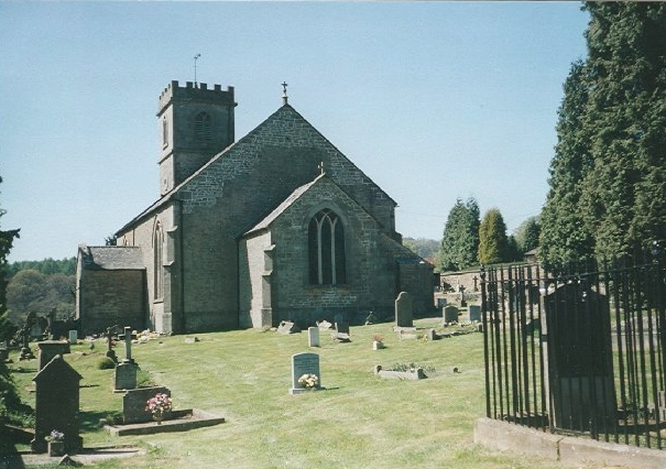
Drybrook, Gloucestershire.
DRYBROOK, is situated just north of Cinderford, in the Forest of Dean. It has a population of about 3000. Just to the north is Puddlebrook, to the west is Ruardean Hill. Nailbridge and Steam Mills lie to the south between Drybrook and Cinderford, while Plump Hill and Mitcheldean lie to the east.
The village originally grew where a route from Mitcheldean to Ruardean passed by at Morse Lane. Two farmsteads were built in the area that later became known as Drybrook Farm and the Morse. (later Mannings Farm). Between 1782 and 1832 the number of cottages in the area grew from 12 to 38. In the late 1800's two new roads became a crossroads creating a focal point for the village to grow and several inns annd shops grew up there. The Hearts of Oak (previously the New Inn) had been built as a beer house in Drybrook in 1838.
|
Industries, largely extractive, such as stone quarrying, coal-mining and iron mining grew up around Drybrook with mines such as Churchway and Trafalgar. A passenger railway line was constructed on the west side of the village to Gloucester in 1907. The station was initially called Nelson Road, but was later changed to Drybrook Road. The village was significantly enlarged after the Second World War and a new parish was created in 1953 to include the surrounding hamlets. The picture (right) shows the disused Severn and Wye Valley Railway, taken on the approach to Drybrook Road Station from the West.
(Click the picture for copyright; click back to return). |

|
 |